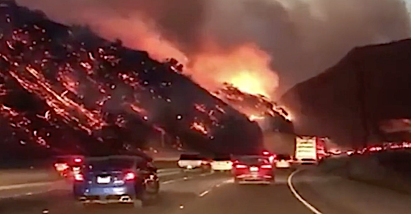
The wildfires in southern California continue to rage on as 100,000 people have just been evacuated from their homes. With authorities warning of strong winds returning this Thursday, it can be very difficult to know where the fire will spread to next. Because of this, navigating in your car can be confusing especially if you're using a navigation app that isn't updating road closures in real time.
According to a report by Jalopnik, LA police have asked drivers to be cautious with navigation apps as some can lead a driver to a street that's engulfed in flames. Although the LA police didn't specify which app not to use, Jalopnik learned that the popular app Waze, is updating in real time and has been in contact with LA's Transportation Department. The company told Jalopnik that:
"All evacuation routes within the app are now currently up-to-date and accurate. Fires are unpredictable but our map will continue to update in real time with information directly from our city contacts."
As of today, Waze has closed 110 road segments of which 13 were identified by LA's Transportation Department. Waze also has a "help" feature to help you find the nearest shelter, and you can make emergency calls without leaving the app.
With these wildfires not showing any mercy, the people in southern California can use all the help they can get.
Related: The California wildfires are so devastating it looks like driving through hell